KABLOONAS

KABLOONAS
Burial of John Franklin. Author: me

KABLOONAS

Kabloonas is the way in which the Inuit who live in the north part of Canada call those who haven´t their same ascendency.

The first time i read this word was in the book "Fatal Passage" by Ken McGoogan, when, as the result of the conversations between John Rae and some inuit, and trying to find any evidence of the ill-fated Sir John Franklin Expedition, some of then mentioned that they watched how some kabloonas walked to die in the proximities of the river Great Fish.

I wish to publish this blog to order and share all those anecdotes that I´ve been finding in the arctic literature about arctic expeditions. My interest began more than 15 years ago reading a little book of my brother about north and south pole expeditions. I began reading almost all the bibliography about Antarctic expeditions and the superknown expeditions of Scott, Amundsen, Shackleton, etc. After I was captured by the Nansen, Nobile and Engineer Andree. But the most disturbing thing in that little book, full of pictures, was the two pages dedicated to the last Franklin expedition of the S.XIX, on that moment I thought that given the time on which this and others expeditions happened, few or any additional information could be obtained about it. I couldn´t imagine that after those two pages It would be a huge iceberg full of stories, unresolved misteries, anecdotes, etc. I believe that this iceberg, on the contrary than others, would continue growing instead melting.


sábado, 25 de abril de 2015

THERE LIES A VESSEL IN THAT REALM OF FROST, NOT WRECKED, NOT STRANDED, YET FOR EVER LOST


"There lies a vessel in that realm of frost,


Not wrecked, not stranded, yet for ever lost;

Morn shall return, and noon, and eve, and night,

Meet here with interchanging shade and light;

But from that barque no timber shall decay, 

Of those cold forms, no feature pass away; 

Perennial ice around th' encrusted bow,

The empty deck, and shatter'd masts shall grow, 

Till from the sun himself the whole be hid, 

Or spied beneath a crystal pyramid'

Few times so few words could have described better the tragedy happened in the Arctic, and so few words could have better described the present situation on which the Terror is eluding the attempts of the Canadian government to find it. It looks like as if the poem had predicted that any shipwreck would ever be found. 

Those, are the words which accompanied the working model over which the Francis Rawdon Moira Croizer statue in Banbridge was based. 


Colossal Statue of the late Captain Crozier, RN

http://archiseek.com/2014/1862-crozier-memorial-banbridge-co/

It was the same sculptor, Joseph Robinson Kirk, who made both statues, the marble model and the statue which is guarding Crozier´s house in Banbridge.  The author of these words, as Randall Osczevsky indicated me, seems to come, or better said: based, from the poem called Greenland by James Montgomery. The poem is much larger and it looks as if some phrases would have been selected to fit in some sort of plaque or engraving in the Kirk´s marble model.  

Joseph Robinson Kirk, R.H.A. Photograph.
http://www.libraryireland.com/irishartists/joseph-robinson-kirk.php
Kirk´s work didn´t end here, he also made a bust of Francis Leopold McClintock whose location is unknown to me and the marble Crozier memorial of Seapatrick church, which Regina Koellner indicated me  was also made by him. The memorial it is described here as follows:

"The two small panel carvings in the niches, with the larger Crozier Memorial (also by J.R. Kirk) in Seapatrick Church, are of considerable merit. All display the Erebus and Terror (the ships of the expedition) starkly embedded in great chunky three-dimensional ice-floes, exciting and near-abstract triumphs of the imagination, as weird and poetic as the rockery mountains invented by Joachim Patinir, and for the same reason: neither artist had ever seen what he sought with such intensity to portray."

Crozier´s memorial in Seapatrick Church, Banbridge
http://freespace.virgin.net/mp.hearth/Banbridge_Crozier.jpeg
Our people in the field, Regina Koellner, Kat Stoetzel and William Greenwell, are doing some researching in Banbridge area right now. Regina has allowed me to show a better picture of the Crozier´s memorial in Seapatrick church:


Crozier´s memorial in Seapatrick Church, Banbridge
Photo by Regina Koellner.
To me, Montgomery´s poem, or its arrangement, is like a premonitory dream. The selection of phrases and words could  have hardly been better chosen. However, no matter what the poem says the truth is that:

The Terror will be sooner than later found, it won´t be forever lost

Not stranded, that for sure, but  shipwrecked and covered of moss,

No decayed timber will be found,  cold waters will preserve them for us,

But her forms will indeed have passed away , about that you can trust

Her empty decks must be found, that is true, but broken and rust 

Her shattered masts won´t grow again, they are not longer holden to the ship fast


jueves, 16 de abril de 2015

ABOUT GRAVES, CAIRNS AND PAPERS

Not long time ago I talked here about other winter places where other expeditions had opened small graveyards during their long stays in the Arctic. They did it while trying to find a way through the Northwest Passage or while looking for the lost Franklin expedition. The more one investigates the more one realises that it seems that the arctic is virtually full of these tiny mini-graveyards or at least it was once full of them. Now we can see only what has been left of them, which amazingly, is more than one could expect at first sight.

Thanks for a link to a webpage which has recently fallen in my hands, kindly provided by the enthusiast Franklinite Regina Koelner, and thanks too because an article, which Peter Carney has facilitated me, I have been able to gather enough information to show you another interesting place  which rests right at the doors of the beautiful but dangerous jaws of the Arctic Archipielago.


Monte Dundas North Star Bay, by Juan F. Abal
Thanks to Juan F. Abal, traveler and great photographer.

The North Star expedition of 1849-50 led by the Master James Saunders is not a well known expedition. However, the historian R. J.Cyriax found it fascinating enough as to write a short article called "The Voyage of HMS North Star". Their  mission was apparently simple, resupplying a rescue expedition which had been sent after Franklin and his men in 1848 under the command of James Clark Ross. James C. Ross together with Edward Bird were stopped in Lancaster sound on board their ships HMS Investigator and HMS Enterprise. Orders said that if James Saunders was unable to find Ross, they had to leave the stores at some specified places on the south shore of Lancaster sound.

The North Star tried to find its target during the summer of 1849, but, after being unable to find Ross, the increasing and growing ice forced them to winter in the northwest coast of Greenland. The ice spat them, providentially before being crushed,  into a free of ice small bay which they called (how not) North Star Bay. Paradoxically, what Saunders didn´t know was that J.C. Ross had come back to England that same summer.

James Saunder was an experienced sailor who had accompanied George Back as master in the HMS Terror in his voyage of 1836-37, however, his expedition was not prepared to winter in the Arctic. They had been specifically ordered to avoid that situation, but orders, are like the wind in the Arctic. Orders can push you into one direction and your fate can push harder you into the opposite one.

They had to fight their way to survive during the killer frozen months when the sun disspears under the horizon. That unexpected situation cost them a high price. Four of the 63 crewmen died during the winter and spring of 1849 - 50. It is said that the deaths weren´t provoked by hunger (remember they carried tons of extra stores to be deployed somewhere) nor by cold, ...by what them? .The fact is that I haven´t found anywhere any reasonable explanation for those four deaths.

North Star Bay is a place which, in my opinion, has certain resemblance with the geographical features of Beechey Island. As it happen in the latter, there are here too steep cliffs and a prominent table-shaped mountain which emerges from the ice in winter and from the seas in summer. That gives the place a creepy atmosphere, where a dwarved ship  beseted at the feet of the mountain by the smooth ice of the bay, looks like if it were lying in an inmensive grave headed by some sort of giant tombstone.

1850 painting by one of the men from the North Star. You can see the ship at the base of Mt. Dundas.
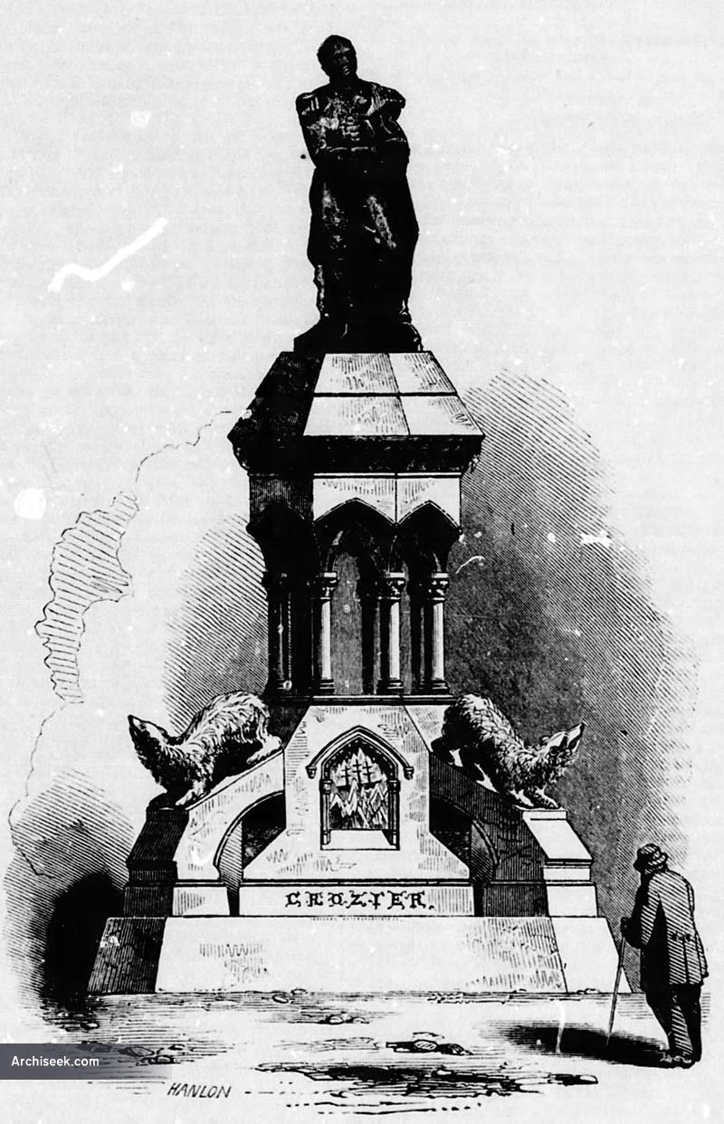
It was in the south coast of this small bay where was built our small graveyard. One mile and a half inland from the beach. The four men died one by one during one winter which a lot of accounts of the time describe as an uneventful winter. Definitely it was not uneventful for the four poor men who were buried there. Close to the graves was built a big cairn which was a matter of discussion for David Woodman in his book Unravelling the Franklin Mistery. But that´s another different story.


Graves of the North Star
http://beyondthebackyard.com/2014/09/03/icy-imprisonment-the-1849-voyage-of-the-hms-north-star/

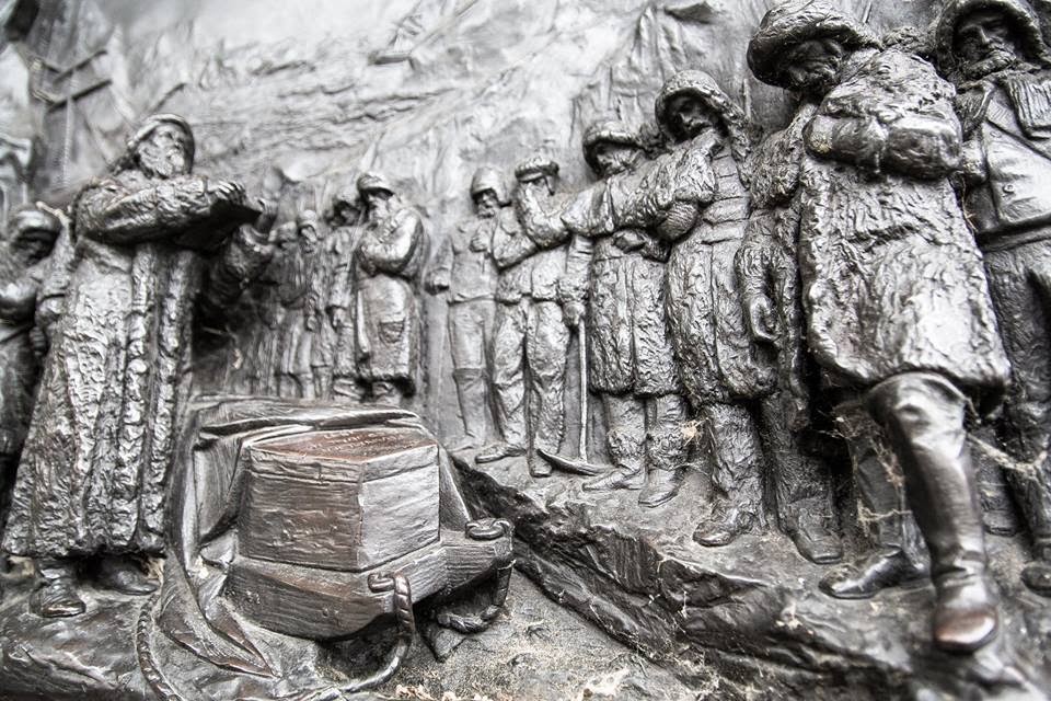
In the course of the first winter endured for some of those Arctic expeditions, usually there were several casualties, normally from one to four and sometimes more. As for an example, the three famous men buried in Beechey Island during the first winter (1845-46) of the last Franklin expedition, four men during the second Parry expedition, three men lost by George Back during his expedition in HMS Terror 1836-37, etc.

Lack of preparation could have been one of the causes. One of the main differences between this expedition and Franklin´s one, for instance, could be that while the Franklin´s one was exquisitely prepared to spend three or four winters in the arctic, the North Star´s one must be back at home before the winter will fall.

Perhaps the selection of the crew was not so rigurous as it could have been for the Franklin expedition. Perhaps James Rae, the assistant Surgeon of the ship could have told us what happened during that winter,...yes, you have read it well, James Rae. And now I will try to answer the question you have in mind. I have found data about two different James Rae of the time who were assistant surgeons in two different websites. In the first, the Tait´s Edimburgh Magazine,  it is said that this man was the son of a John Rae from Myre, Orkney Island (suspiciously close to the location of the Hall of Celestrian). He died in front of the coast of Biafra, Africa on board a steam vessel called Pluto. Likely the ship which was capturing slave ships in 1860.

Capture of a large slave ship by HMS Pluto 1860

The second reference
states that this James Rae was born in 1821, and that he was the one who participated in the North Star expedition of 1849-50. He was the son of a Doctor called John Rae, at St Ninians (near Glasgow I think) but there is no mention about our beloved John Rae the famous explorer. Could that important data be omitted? I find that fact of such significance as to be mentioned in his short biography. If he was, then I didn´t know John Rae´s brother was a Polar explorar too! Tons of paper would have been written about  John but not too much about his brother. I couldn´t find any decissive clue in the books "Fatal Passage" or in "Lady Franklin´s Revenge" nor in some other books. Should we then think that they weren´t actually brothers?.

Returning to North Star bay, it has taken me some time to identify where the four graves of these poor sailors were dug. At first, I though they were placed in the flat istmus which links Mt Dundas with the mainland. After, and according to certain pictures, the drawing of the burial site, and thanks to a short description of the place.  I have located the graveyard  at the other side of the bay, in the south coast and close to the harbour. The mountains in the background must correspond with those at the other side of the Pituffik glacier. 


North Star Bay and Mount Dundas at the background
https://en.wikipedia.org/wiki/North_Star_Bay#/media/File:Thule_air_base_above.jpeg 

There is at least one burial plot on the istmus but it seems clear that the remains of these men were buried on the other side of the bay,
William Sharp grave
http://www.thuleforum.com/rose/index_1.htm

James Saunders left several cairns with records which were found time after for other rescue expeditions. One of the recovered  notes reminds me strongly the sober content of the sadly famous Victory Point Record left by the Franklin expedition in King William Island. The note reads:

" This paper is placed here to certify, that H.M.S, ' North Star ' was beset, at the east side of Melville Bay, on the 29 th of July, last year, and gradually drifted from day to day, until, on the 26th of September, we found ourselves abreast of Wolsten holme Island; when perceiving the ice a little; more loose, and the Sound perfectly clear, wo made all ])lain sail, and pressed her through it, anchoring in the lower part of the Sound that evening, and arrived in the Bay on the 1st of October, whereshe remained throughout the winter.

It is my intention to leave as soon as the breaking up of the ice will permit, and prosecute my voyage in search of the Arctic ships.

(Signed) J. Saunders, Master adn Comander
.
" North Star Bay, Wolstenholme Souud, "April 15th, 1850. " Lat. 70º 3´ N.; long. O" 30' W."

They found some other papers telling the same story, in the back of one of them were written the names of the men who died in that desolate place. The paper said:

William Sharp, A. B., died 1st of November, 1849

William Brisley, boatswain's mate, died 3 1 st of January, 1850.

Richard Baker, A. B., died 7th of April, 1850. 

George Deverell, A. B., died 17th of May,

"As we contemplated these sad memorials of our departed countrymen, one consolation was felt by us " they had died surrounded by friends, and by all the appliances which a Christian charity could afford; and their last wishes were confided to those who had been their fellow-sufferers throughout a dreary and wretched Arctic winter. Thus far they had been happy; but when we recal the glowing anticipation that swelled our breasts, on joining our Expedition; when we think with what fondness we dwell upon the happiness that will gladden our hearts, as the shores of dear England will again burst upon us; we may be permitted to let fall a tear, and to pity the lot of those whose remains lay amid the granite monuments of nature, thousands of miles from their native homes."

It is funny because another fellow Franklinite, Randall Osczevsky, raised not long time ago the issue about why James Fitzjames and Crozier left so scarce information on the paper they left under the cairn of Victory point if they had a whole blank side of the paper to explan all the proceedings of the ships till the date. They even scribbled the margins of it but it seems that they despised, or never thought on, the idea of writting in the back side of the paper,...well. James Saunders did that, why didn´t they do?.

The graves and the records were not the only thing the James Saunder´s expedition left in the Arctic. They left too their stores, as far as Wollaston Island, a place close to the mouth of Lancaster sound. The cache was soon looted, apparently by locals.

Only one tombstone remains there, that of William Sharp. The others seems to have dissappeared. I have read that this one was  moved further inland, perhaps the other were swallowed by the increasing level of the sea forever. The grave of William Sharp is and will be there for now witnessing how war ships come to the shores of the North Star Bay and see how planes land and take off from the Thule air base which was built there.


To see the Grave of William Sharp visit this place:
tp://www.arcticphoto.co.uk/supergal/QQ/qq97/qq9741-17.htm


miércoles, 8 de abril de 2015

WE ARE ALL DEAD - ANOTHER KING WILLIAM LAND

"We are all dead" were not the words of Priscillian when he asserted that we humans actually live in Hell. Those were words written down in the vaste loneliness of north Greenland by Jørgen Brønlund when he realised that he and his  two companions were condemned to die. I know I am putting a foot out of my favourite century (the XIX) but, please, forgive me. I am only placing my toes in the first years of it and I hope you all will agree with me that this will be justified enough.

The tragic end of Jørgen Brønlund and his two mates is very similar in more than one sense to the Scott´s one though much less known. He died while returning from the furthest point reached, rescue parties were very close to find them when they still were alive and his journal was found perfectily legible together with his body. The tone of his last entry is much colder and sober than the tone used by Scott and allow us to understand perfectly well how Inuit people confront the death. There are, however, several factors about their end which should bring to our minds other existing parallelisms with events which could have taken place during the retreat of the men of the Franklin expedition.

Jørgen was a man of Inuit ascendency and was the interpreter, dog-team leader and the man responsible of writting the diary of the Denmark Northeast Greenland expedition which should last from 1906 to 1908. While other nations were struggling and vanishing in the arctic archipielago or in Hudson Bay the Danish people, like a stubborn army of ants, had been  exploring and mapping that great island, which it seems was once indeed green, for at least 170 years. However, in spite of this close siege, there still remained few areas of the shoreline to be discovered and properly mapped.

Jørgen Brønlund
http://en.wikipedia.org/wiki/File:J%C3%B8rgen_Br%C3%B8nlund.jpg
Three men died during that expedition, and they died mainly due to the inaccuracy of the geographical data collected by Peary during his previous attempts to reach the North Pole  from the north tip of Greenland some years before. Three men, Mylius-Erichsen, Hoeg Hagen and Jørgen, died because they were forced to follow coast lines which trend to the east instead of to the west, as their maps indicated,  and were distracted by unexpected long fjords which cut their way and which didn´t appear on their maps. Those distractions obliged them to spend a not wanted summer in the north and therefore to slow radically their pace. The strategy followed for overland expeditions is exactly the opposite to the strategy followed by naval expeditions. Where exploration ships look forward the summer to advance among ice free waters, explorers who use sledges, prefer the snowy and smooth landscapes to fly hundreds if not thousands of kilometers at a high rythm. The arrival of the summer for a sledge party at hundreds of kilometers from their base camp could mean death.

The dangers hidden in the arctic are numerous, perhaps the most unpredictable  of all of them could be an inoffensive map. Yes, a single, simply and plain map. Maps with mistakes, even with minor ones, could kill hundreds of people on those times. Wrong maps unveiled themselves as unexpected, inexorable and improbable murderers.

As it happened with the errors comitted by Peary on drawing his maps, the fictional Poctes bay, a bay which had been perceived, or better said, intuited by James C. Ross and by Dease and Simpson during their respective expeditions, could have meant the death for a group of men from the Franklin expedition if not responsible of the death of the whole group.


From:  Narrative of a second voyage in search of a North-west passage
If Poctes bay had existed some men could have travelled eastwards over its istmus to the mainland and from then towards the Inuit settlements of Repulse bay, as if it that istmus were a yellow brick road or just a providential gangway placed there to allow them their salvation.  As it didn't actually exist perhaps some men were stopped in the east coast of King William island after having abandoned their boats with the hope of being able to find a passage of land to the east.

On the other hand, if Poctes Bay hadn´t existed on that map the Erebus and Terror could have made their way south by the safer and usually ice free east side of King William Island and have therefore completed, perhaps safely, the route of the Northwest passage.

So, the same as a proffesional killer who wants to be sure his victim is not going to stand up again, that dotted line which marked the (darn it) 'likely' existence of that itsmus on the map, could have condemned the expedition not merely in a single way but, as we have seen, in two different ones.

But let´s return to the eternally frozen shores of east Greenland. Twenty eight men composed the expedition which was called the Danmark Expedition to Greenland´s Northeast coast 1906-1908.  On board of an appropiatelly called ship "Danmark" the expedition wintered about the latitude 77º in  a land called Germania. From there several sledges trips were dispatched. Several to say something,  in fact two hundred sledge trips were sent in two years, TWO HUNDRED. The ship carried one hundred dogs on board. You can picture the situation. This herd almost provoked the collapse of the expedition when during the outward journey all of them escaped and wandered freely over the decks for some time  eating and destroying everything at sight with no restrictions.

It is remarkable to mention that one of these sledge parties performed a distance of 315 km in only five days, that means an impressive rate of 63 km a day, an incredible distance. At the sight of those numbers one have to wonder if Peary could have really reached the pole after all. mmmm! Just a thought.

The longest journey and the biggest party included ten sledges. Its target was going north to map the blank areas. It was performed at the usual style of sending back supportting teams and deploying depots all over the way. One of the participants of one of the teams which was sent back was the famous Alfred Wegener. Six men reached the northeastern point in Greenland. It was planned that the party would split in two teams. One led by Mylius had to go west and the other led by Koch had to travel north towards Kap Birdgman, one of the points discovered by Peary.

Both parties met again at the end of May south of the Independence Fjord after months of arduous work. They planned at first to come back together towards the ships but, as the west party hadn´t been able to fulfill its target after having found some unexpected obstacles, a day after, in spite of the advanced season, Mylius splitted again travelling westward towards Navy Klippe in an attempt to finish the job.

The summer fell over those poor men forcing them to walk over stony and bare ground destroying their boots and doing impossible the use of sledges. They tried to come back to the ship retracing southward the route that they have been following north that previous spring but the shores of Greenland were this time free of ice and presented for them impassable waters. The east coast of greenland is treacherous and capricious, she shows herself sometimes free of ice and sometimes blocked with a thick layer of ice. It was in front of those shores where Franklin was repudiated by the ice on his attempt towards the North Pole. If you analize the map below you will notice how all the expeditions which wandered close to this area were unable to go north of Cape Bismark.

That was the end. That fact forced them to go inland and walk over the ice with their half destroyed shoes. The lack of game and their feet frozen to the bone made them to stop and die of hunger and cold while trying to reach safety. The Koch party had travelled meanwhile over 2.000 km, the three men had a hard time to return home but they survived. You can read the whole story in the chapter dedicated to it here.
Arctic regions : with the tracks of search parties and the progress of discovery, compiled from the latest information / compiled by A.C. Roberts ; lithography by Gr. Noetzel.
You shouldn´t be surprised at this point that the part of the arctic map which was still unmapped in 1896, the northeast part of Greenland, was located at the north of a region called King William Land. The tragedy seems to have flown over areas called  King William Land twice . 

The Mylius party perished while trying to reach one of the depots deployed during the outward journey, the Lambert depot.  Mylius and Hogen died before reaching it and their bodies were not found. Only Jorgen found the strength enough to reach a point where he knew his body and diaries would be found. His will drag him to this place beyond human limits.

His last  entry says:

“Died 77 Fiord after attempt return home across the inland ice, in the month of November. I come here by waning moonlight, and could no more from frostbitten feet, and because of the darkness. The bodies of others are in the middle of the fiord in front of glacier (c. 2½ miles). Hagen died 15 November and Mylius about 10 days later. Jørgen Brønlund”.


http://thewe.cc/thewei/&/poles/arctic/danmark_expedition.jpg

This journal and other records, left under cairns during their desperate struggle, were brought home and from them we know now how those poor men ended. As always happens under these circunstances,  they died surrounded by misery, cold, hunger and pain.

This finding is less known but it increases the list of journals that have been found in polar regions which have brought us vividly the tragic death suffered by their writers. Let´s review them: Scott´s journal was found months after his death, the journal of Solomon Andree was found about 30 years after his death also close to his remains, pages of the journal of one of the men which vanished in the arctic from the Brussilov expedition were found in the arctic one hundred years after their deaths, the journal of the commander DeLong from the Jeannete expedition was also found with him a year after they died in the Delta of the Lena.

I know there are more paralellisms with the last Scott´s expedition than with the Franklin expedition but the effort of this man to reach a point where he knew could be surely found, should make us reflect that the men of the Franklin expedition SHOULD have left a more complete record somewhere in King William Island, in a place where it would undoubtedly be found. I can´t think in any other better place than the Victory Point, the James C.  Ross North Magnetic Pole point or the Dease and Simpson cairn in Cape Herchel. Thorough  archaeological excavations shoud be launch to those three areas or to those significant gegraphical points we know were already known in 1845.

To end the story, it has been a happy and fascinating coincidence discovering that Tom Kjeldsen have drawn the whole route followed by this expedition in an amazing detail, so, if you are lost among all these names and geographical features which have been described above you could find here a detailed Google Earth file which will allow you to find your way back safely home. Besides that discovery has given me the idea of publishing my "permanently at work "botched job in the Google community when I finished it.